Flickr is a free, photo sharing and management application that is available online. This website not only allows people to upload and store their photographs, it allows users to share and browse a vast library of photographs. Photographs on Flickr can be tagged, or associated with specific terms, that allow them to be sorted and located in many different ways. Photographs can also be geotagged, or linked to a specific location. With advanced search options and thousands of photos available through the Creative Commons, Flickr is a wonderful source for educators to find photographs that enhance learning.
In the classroom, I view Flickr as a highly valuable instructional resource. It can be used to locate and share photographs that represent significant people, places, and things. These photographs (if rights allow) can be used in presentations, lessons, and projects. These drastically enhance instruction as they provide a visual perspective of information. With Flickr, students can digitally explore places to build a contextual understanding. For example, if studying about the marsh/swamp habitat, a student can use the search feature to browse an extremely large pool of photographs related to that region. These photographs help students construct knowledge of the habitat. Exploring and studying photographs related to that specific region (and viewing the location on an interactive political map) allows students to build a contextual understanding of that geographic region or location. Flickr would also be an awesome way to construct or partake in a virtual field trip. Aside from using Flickr to find photographs to enhance presentations, here are some other ideas I have for using Flickr in the classroom: locating thematic photographs for writing prompts/assignments, creating content specific PhotoStory project, visual documentation of student work for portfolio, and photo sharing with global ePals.
(See Photograph Below) This is one of the many photographs I found when browsing through coastal habitats. This photograph can be tied to several of the science standards taught in third grade. We study about the regions of Georgia, one of those regions being the Atlantic Coast. We also study types of soil. Students learn that there are many different types of soil, including sand. Plants that grow in sandy soil are very unique because they get very little nutrients from the actual soil. Because sand does not hold water, these plants take in a lot of water at one time, but can go for periods of time without water. This picture provides a perfect example of a plant that thrives in sandy soil. Visible adaptations for survival are also evident in this photograph. I would ask students to observe the picture and to predict what adaptation is visible.
Photograph Credit:
Joe Shlabotnik and can be accessed at http://www.flickr.com/photos/joeshlabotnik/363114745/
In the classroom, I view Flickr as a highly valuable instructional resource. It can be used to locate and share photographs that represent significant people, places, and things. These photographs (if rights allow) can be used in presentations, lessons, and projects. These drastically enhance instruction as they provide a visual perspective of information. With Flickr, students can digitally explore places to build a contextual understanding. For example, if studying about the marsh/swamp habitat, a student can use the search feature to browse an extremely large pool of photographs related to that region. These photographs help students construct knowledge of the habitat. Exploring and studying photographs related to that specific region (and viewing the location on an interactive political map) allows students to build a contextual understanding of that geographic region or location. Flickr would also be an awesome way to construct or partake in a virtual field trip. Aside from using Flickr to find photographs to enhance presentations, here are some other ideas I have for using Flickr in the classroom: locating thematic photographs for writing prompts/assignments, creating content specific PhotoStory project, visual documentation of student work for portfolio, and photo sharing with global ePals.
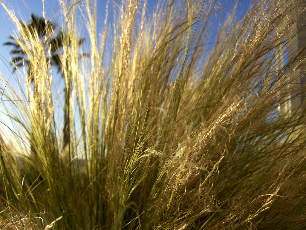
(See Photograph Below) This is one of the many photographs I found when browsing through coastal habitats. This photograph can be tied to several of the science standards taught in third grade. We study about the regions of Georgia, one of those regions being the Atlantic Coast. We also study types of soil. Students learn that there are many different types of soil, including sand. Plants that grow in sandy soil are very unique because they get very little nutrients from the actual soil. Because sand does not hold water, these plants take in a lot of water at one time, but can go for periods of time without water. This picture provides a perfect example of a plant that thrives in sandy soil. Visible adaptations for survival are also evident in this photograph. I would ask students to observe the picture and to predict what adaptation is visible.
Photograph Credit:
Joe Shlabotnik and can be accessed at http://www.flickr.com/photos/joeshlabotnik/363114745/
 RSS Feed
